Parish Council Map 1975
The Civil Parish of Southbourne was created in 1967 and this was the official Street Plan issued by the Parish Council in 1975. It was given to me by Eileen Pledge who I believe had been a clerk or assistant clerk at one time.
Before Parochial Parish of Southbourne was created the central area was known as Prinsted and the old school, where the Social Club is now, was Prinsted Board School. In 1876 it became Southbourne Council School when Board Schools were abolished.
The Chapelry of St. John the Evangelist was created when the church was completed in 1876.
The railway came in 1946 splitting the Westbourne Parish and so the church was built in the south.
Main Road was the A27 until the new motorway opened in 1989 and this is now the boundary with Westbourne.
In 1960 the New School in New Road opened in May with 3 classes.
The 3 classes remained in the Horsa building, (built in 1945) until 1975.
This became Age Concern in June 1976.
The school extended and the Junior School opened in 1975.
Mid 1960's the Old Victorian School on the corner of New Road was demolished and the Social Club built.
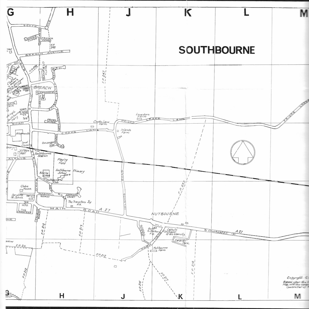
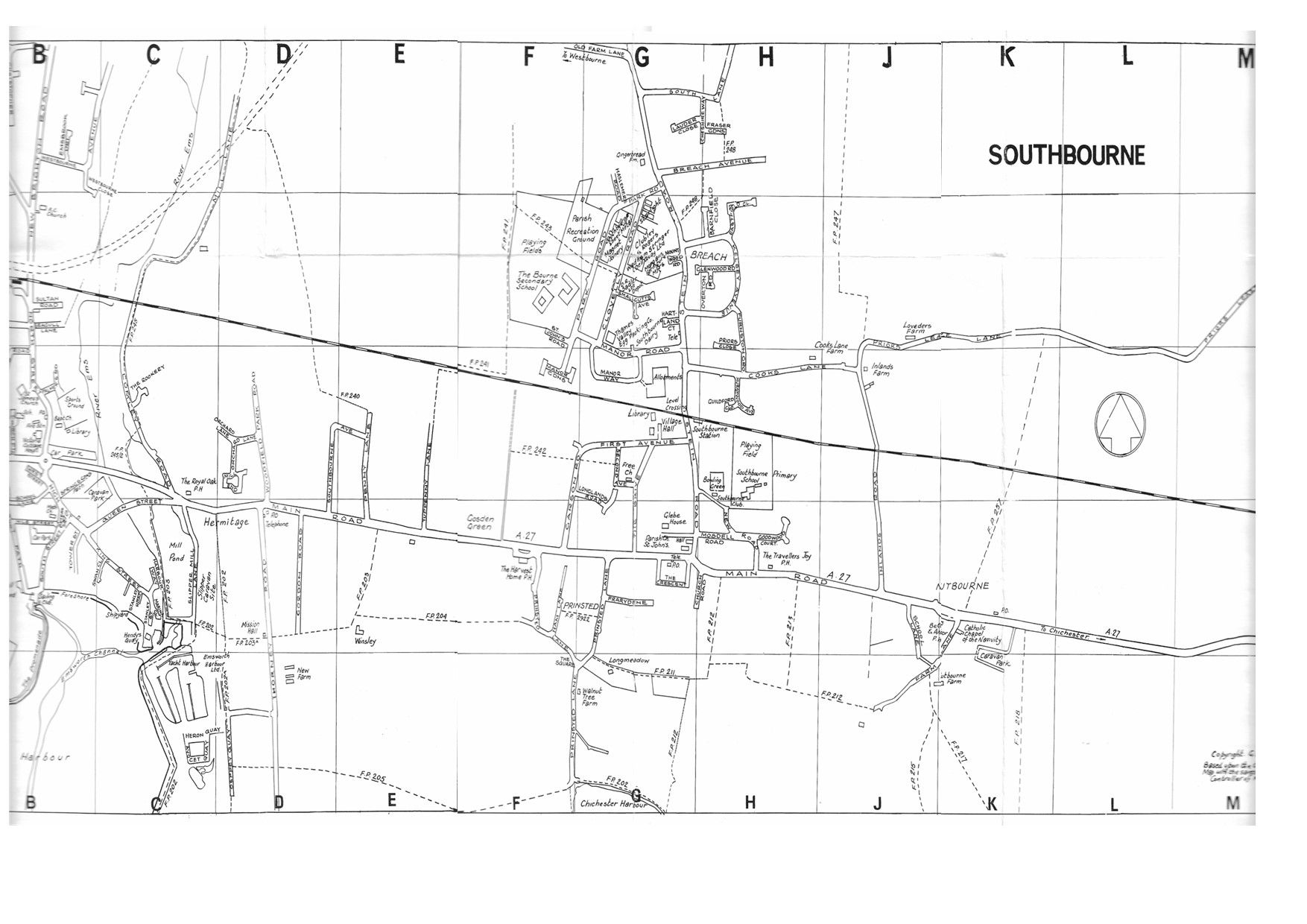
Footpath numbers can be clearly seen on this map. and I have enlarged it into 3 sections below.
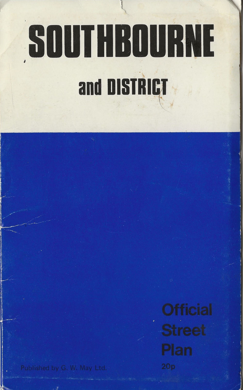
1975 Parish Map Cover
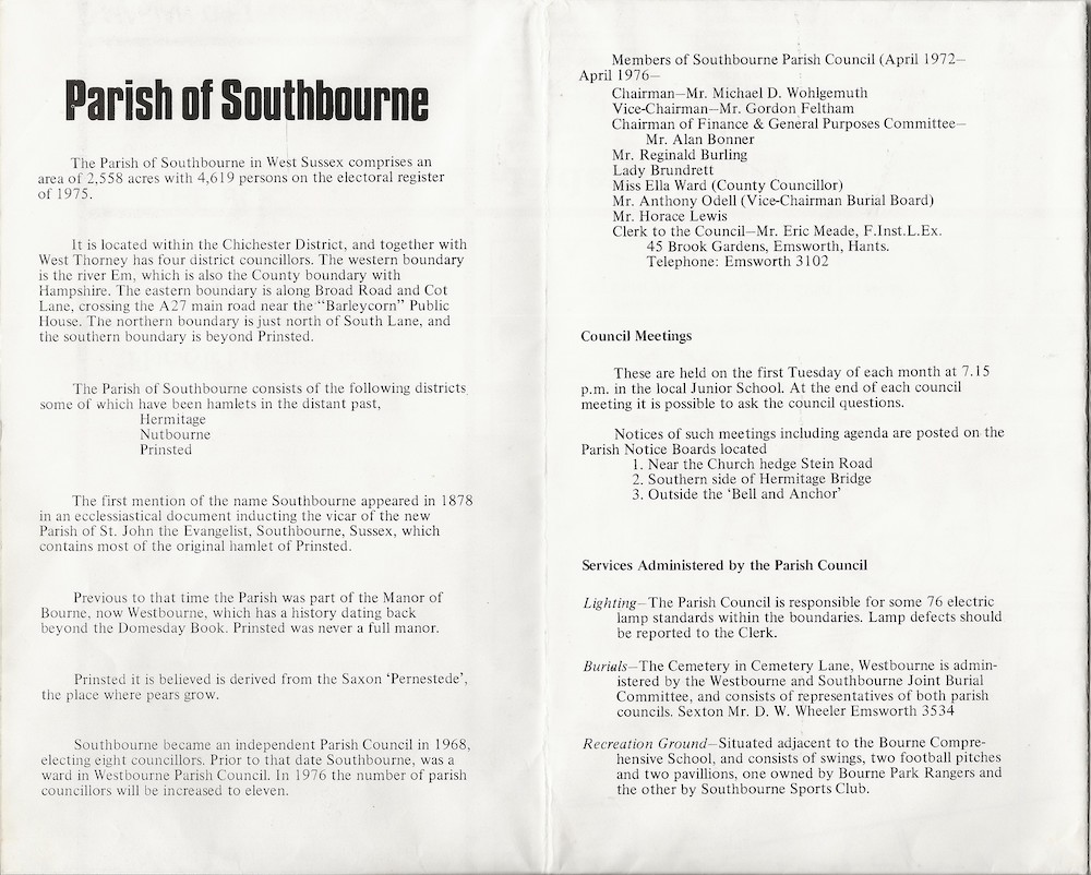
1975 Parish Map Information
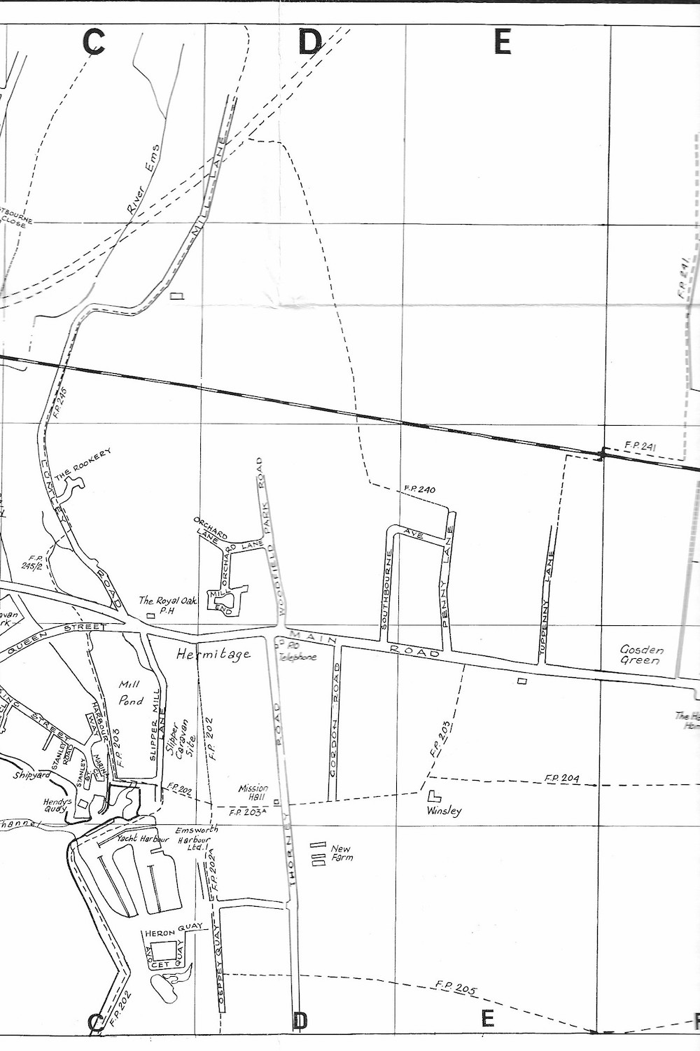
1975 Parish Map - West
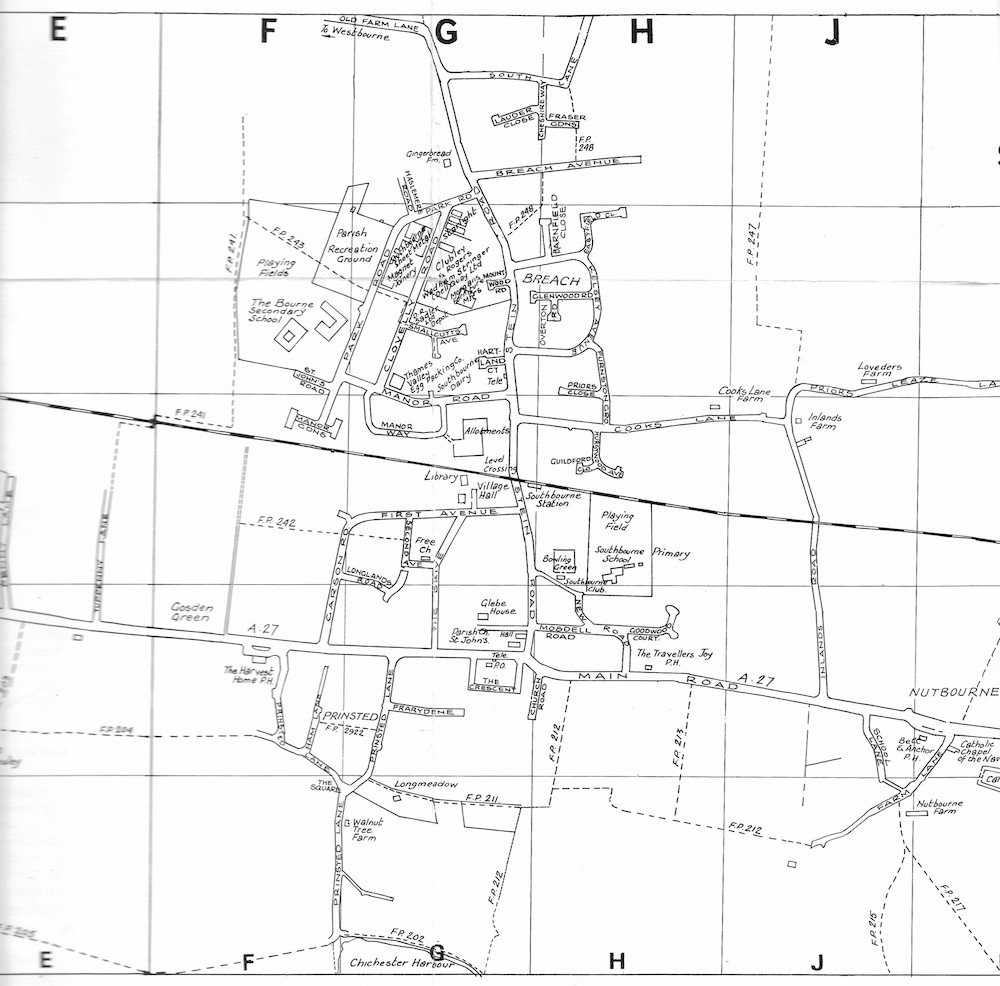
1975 Parish Map - Central