Geography
On the Edge of the County
The Civil Parish of Southbourne includes settlement identities that should be retained. Historic boundaries and names, some of which are in the Domesday book, are our local history and are very helpful when researching your family tree.
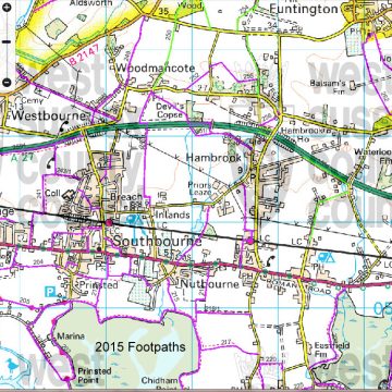
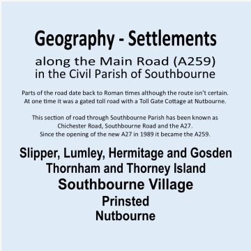
Lumley, Slipper, Hermitage, Gosden Green, Thornham, Thorney Island, Prinsted and Nutbourne are the original settlements along the Turn Pike Road between Portsmouth and Chichester.
The old Wessex border was the Hampshire/Sussex boundary. It has been moved in places to accommodate new roads.
The name Southbourne first appears in 1876 when on completion of the building of the church, the Chapelry of St John the Evangelist was registered with the Church Commissioners. The whole area remained in the Parish of Westbourne, where births, deaths and marriages were registered.
The central area was Prinsted, and the old school in Stein Road, built in the 1840s was Prinsted Board School. In 1876 the name changed to Southbourne Council School when Board Schools were abolished. We remained in Westbourne Parish and the Parochial Parish Council was formed.
The Civil Parish administration of Southbourne that we know today, was formed in 1967.
Our border with Chidham changed in 2014 when parishes were undertaking their Neighbourhood Plans. The Chidham border was moved west from Cot Lane/Broad Road to well passed Pottery Lane and this area became Nutbourne East.
Extensive building along this section of the A259 between Havant and Chichester will, by 2030, change our villages beyond recognition and we are in danger of merging.
I think it’s important we keep using our historic village names in our addresses to retain our history.
The PO10 8?? post code is West Sussex and covers parts of both Southbourne and Westbourne.
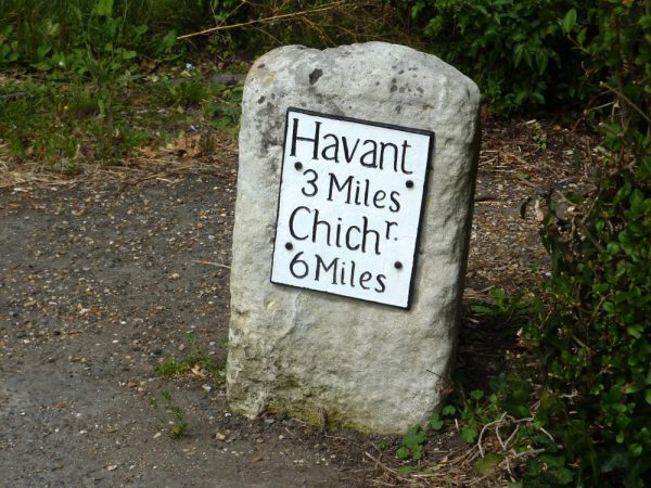
There was a Toll Gate cottage at Nutbourne, demolished when they changed the road layout.
It was east of the Thatched cottage on a island of its own. '
A turnpike is a defensive frame of pikes that can be turned to allow passage of horses, but in this context, it refers to a gate set across the road to stop carts until a toll was paid. Empowering trustees to erect turnpike gates was the most successful mechanism for ensuring that the costs of improvement and maintenance of a road was financed by the beneficiaries. During the first seven decades of the 18th century, a comprehensive network of turnpike roads was created across Britain. These linked the major centres of population by highways which were, in principle, reliably financed and operated for the benefit of long-distance commercial traffic, rather than to satisfy the limited needs within individual parishes. Although the turnpikes receive much attention, only one-sixth of English roads were turnpiked (Hartmann 1927). The majority of the roads and lanes remained the responsibility of the parish and were toll-free. These were repaired solely by Statute Labour until the General Highways Act of 1835. Enclosure of the old open fields during the 18th century created new, often straight, local roads and rationalised the more chaotic, ancient patterns.