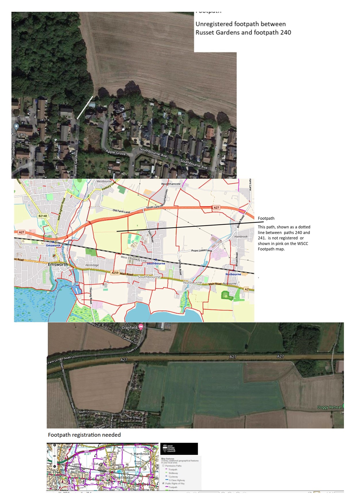
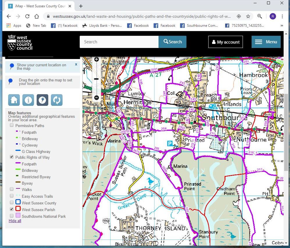
Footpath Map
This Footpath map is dated 2015, and is on the West Sussex CC website, see below.
The ones in pink are numbered and registered as footpaths.
The footpaths shown below are not registered and in response to a number of requests I sent details to the Parish Council in July 2021. They may not be able to register them of course, I have no idea of the procedure, but I thought you might like to know that these three have been reported.
A cut through from Russet Gardens to the field
The footpath across the field behind Bourne College
The path next to the motorway from Stein Road to just past South Lane