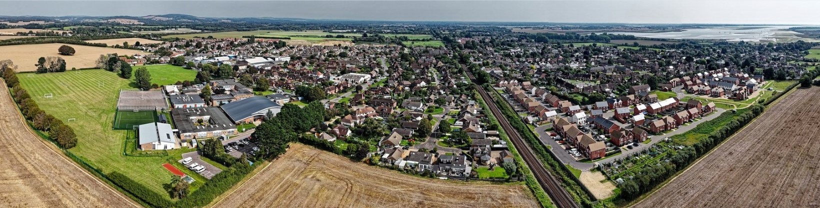
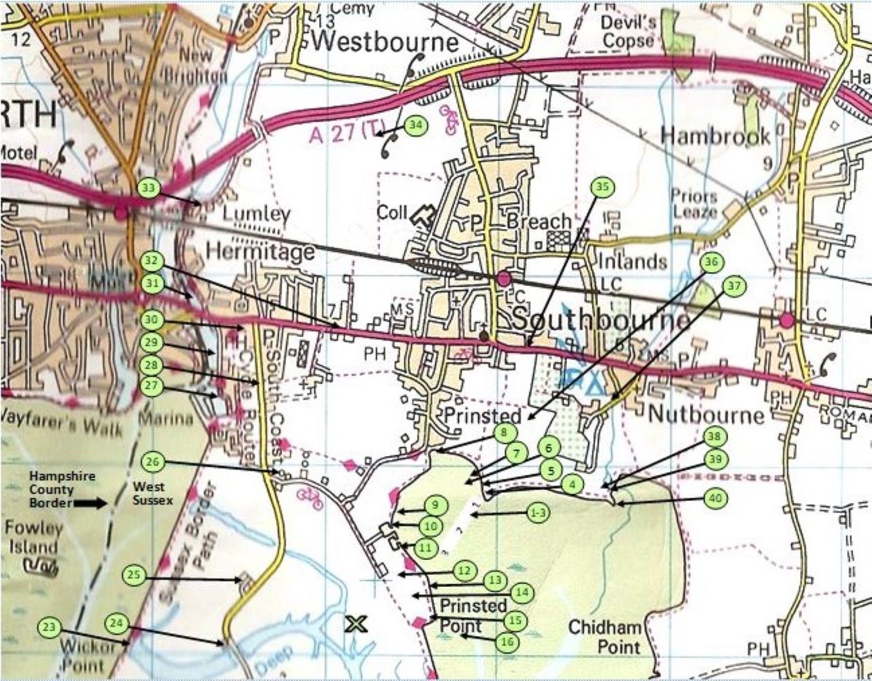
Map - Southbourne Scenes
The map was compiled by David Holman and produced by Ruth Heelan following some confusion when, in stories David wrote for the Southbourne (West Sussex) Community Group, Facebook Page, he would use a local name such as "the goat ladies field." I said if you do that you are going to have to do a map. It took him sometime to do and me sometime to decide the best way to lay it out and produce it, but we are pleased with the result.
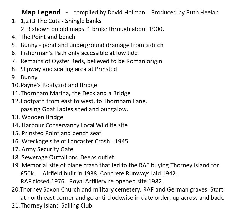
Local features of the Parish of Southbourne have been marked using numbers and arrows.
Southbourne Scenes photos
In the Summer of 2022 we asked for photos of the various locations.
This was contributed to by many walkers and completed in summer 2023
The numbers start at The Cuts to the east of Prinsted Bay and take you to the west side to Thornham. Then around Thorney Island up to Slipper, across Main Road to Lumley and ends at Nutbourne.
Please scroll down through the photos.
Learn more about The Deep at No 23


Below is a link to St Nicholas Timeline, which gives a lot of the history of the church and the island.
https://www.stnicholastimeline.org.uk/thorney-stories
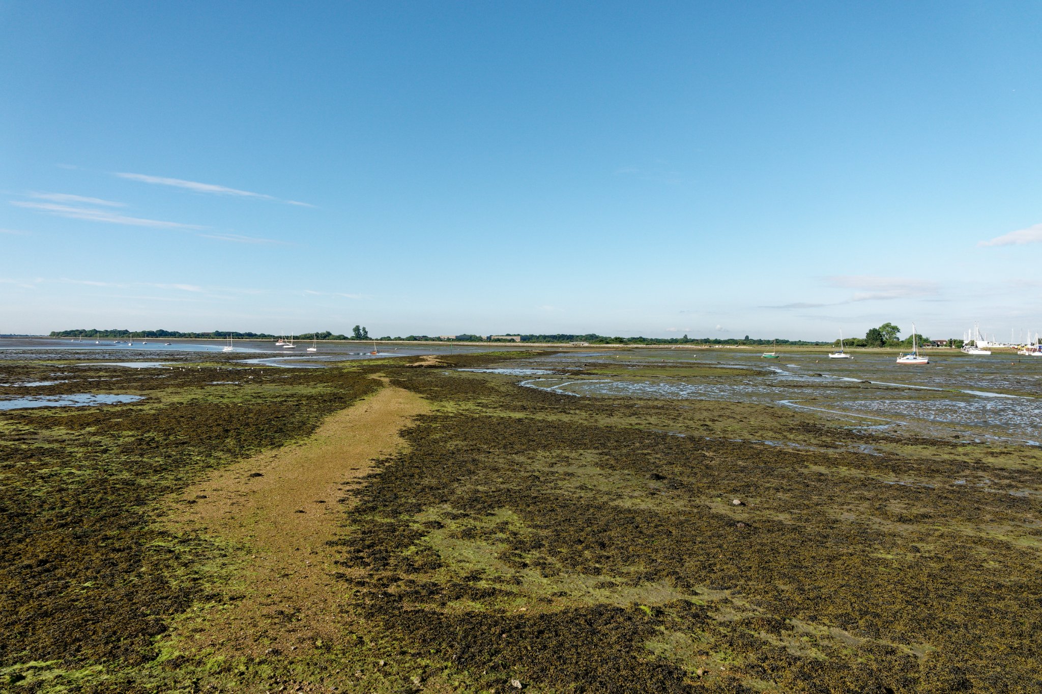
The cuts are the remains of the barrier built to control the water flow over the oyster beds which were on the eastern side of Prinsted Bay.
We are told the Prinsted beds could date back to Roman times.
Emsworth's oyster industry was devastated by the great oyster scare of 1902, when guests at a Winchester banquet became ill and the Dean of Winchester died from typhoid attributed to eating Emsworth oysters at that event.
Following inspection of the oyster beds gross sewage contamination was identified. The Emsworth oyster trade was ruined.
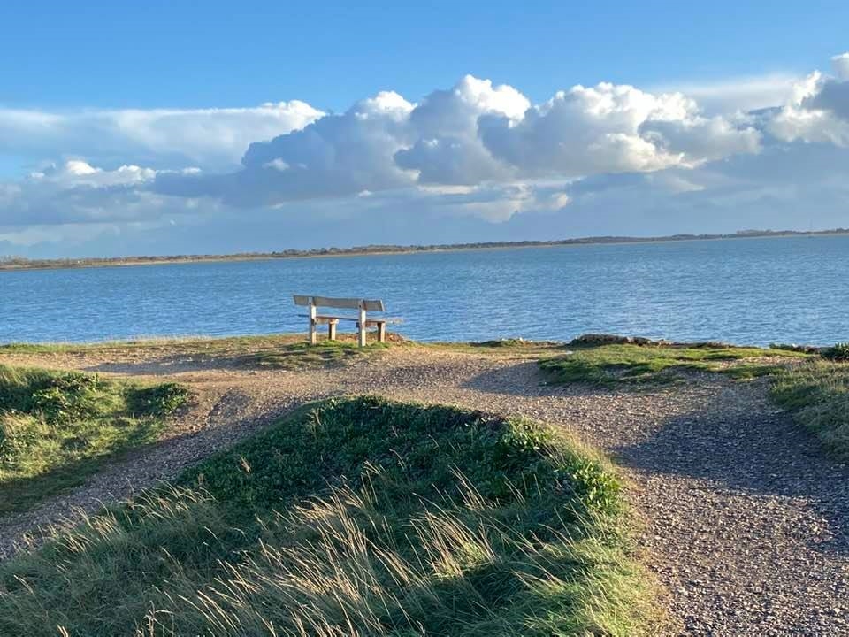
No 4 The Point and bench which is dedicated to Jessie Kenning. It was replaced in 2020 as the original had fallen down. There are a number of family members still living in Southbourne.
The memorial benches along the footpath are controlled by Harbour Conservancy and they have a replacement only policy. A second bench was requested in at this location in 2020 in memory of John Southgate who was instrumental in getting the path upgraded to wheelchair suitable, but this was not permitted.
William Saywell shares many pictures of Southbourne on our closed Facebook Group - 'Southbourne (West Sussex) Community Group' and they are appreciated by residents. I thought I would share this winter one of the bench which was taken on 2nd January 2024 as Storm Henk was passing through.

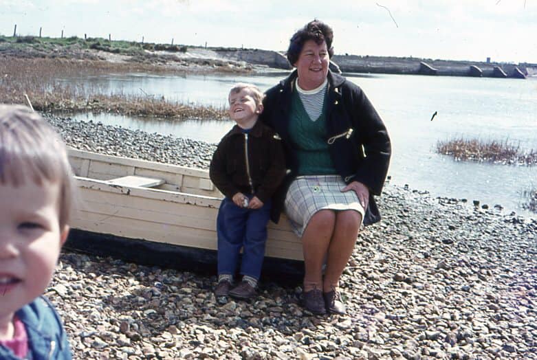
Below: Jessie Kenning. Jessie and her daughter Joan, lived with the Holmans during the war in Prinsted. They moved to Padwick Villas, Main Road and then to 1 Elm Grove, Nutbourne. Joan married Brian Plumb who lived at No.2. Joan helped at Southbourne Age Concern for many years.
No. 5 Bunny - pond and underground drainage from a ditch
awaiting Picture
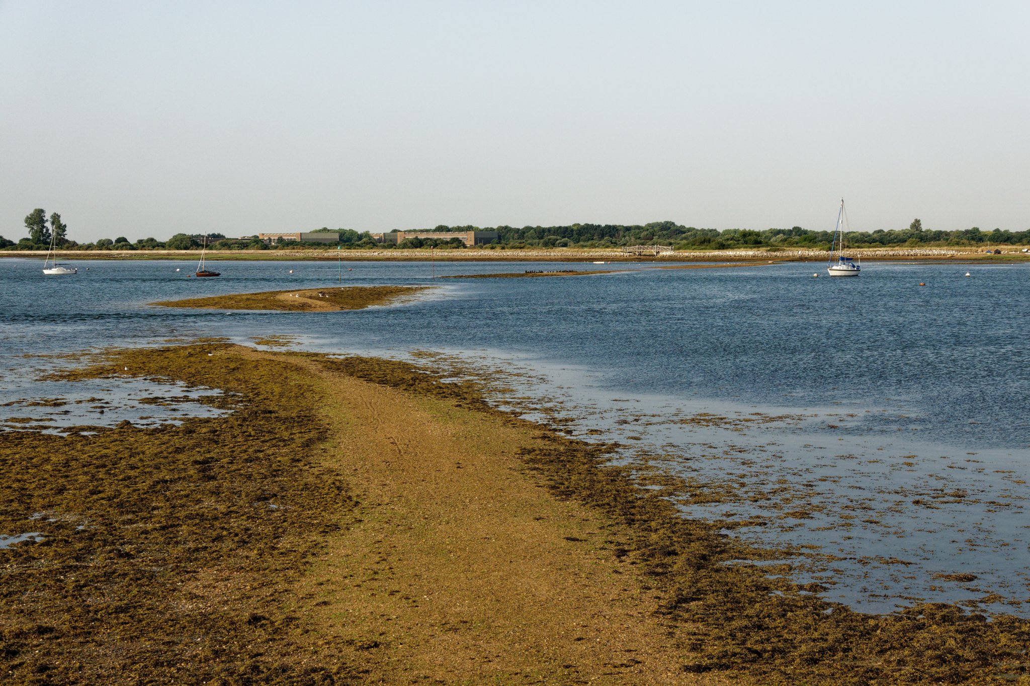
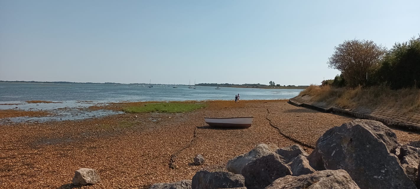
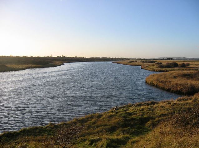
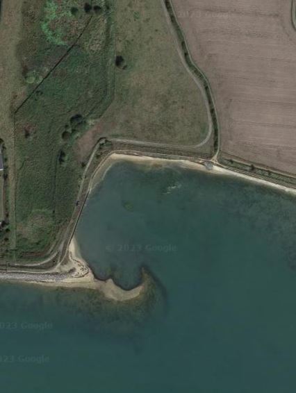
No. 6 Prinsted Bay high tide. cuts and fisherman's path only accessible at low tide. Google earth aerial view.

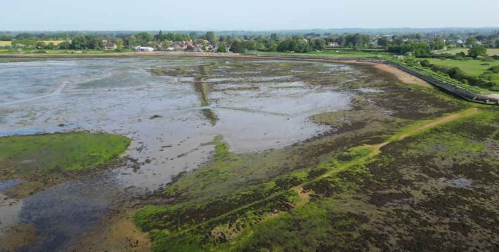
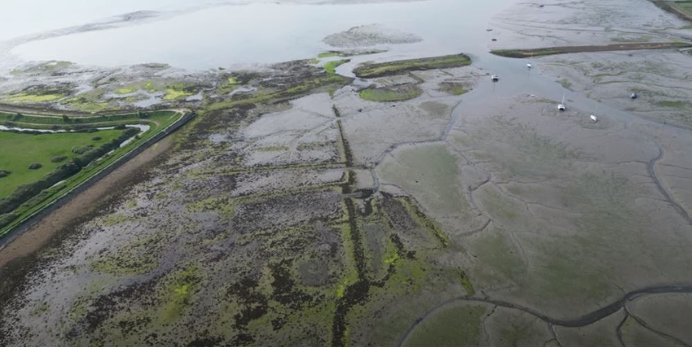
No. 7 Remains of Oyster Bed, believed to be Roman origin


90th Anniversary event involved Beavers, Cubs, Scouts and Explorers. Over 150 youngsters meet in the club house weekly during term time.

No. 9 Bunny - awaiting picture
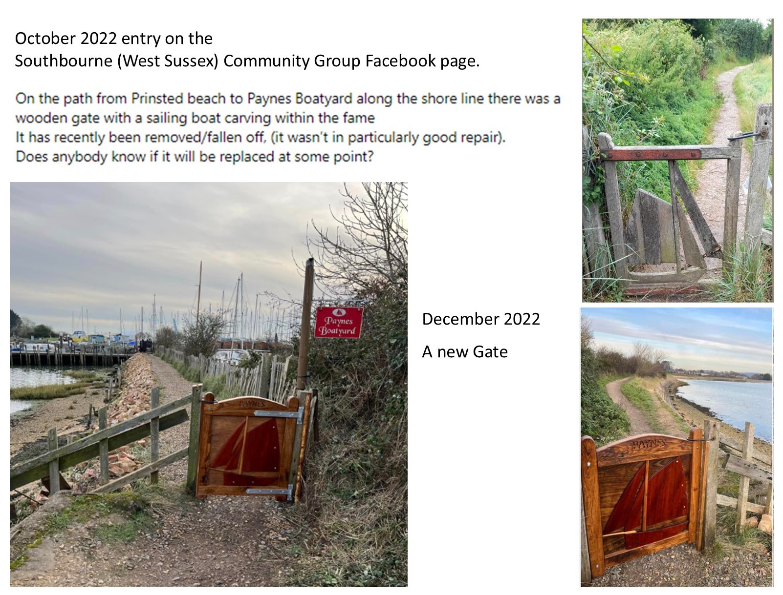
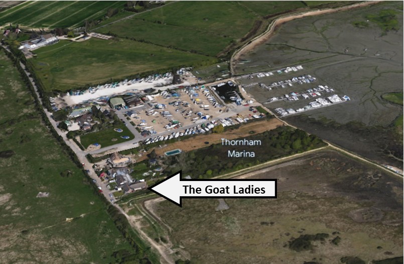
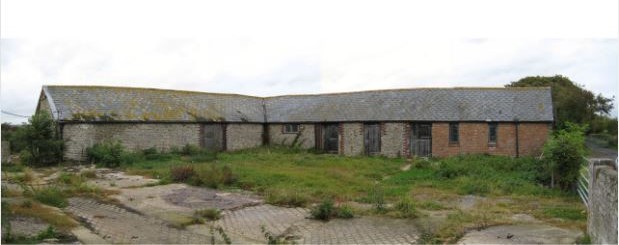
No. 10 Paynes Boatyard. Thornham Lane, Southbourne, West Sussex PO10 8DD

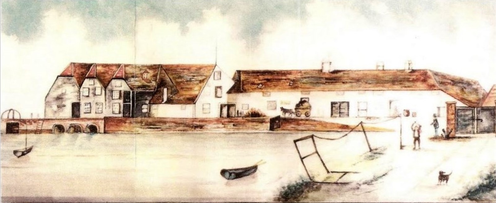
No.10. Painting of the original old Paynes Boatyard bridge by Richard Joicey a marine artist who once lived in Langstone Mill.
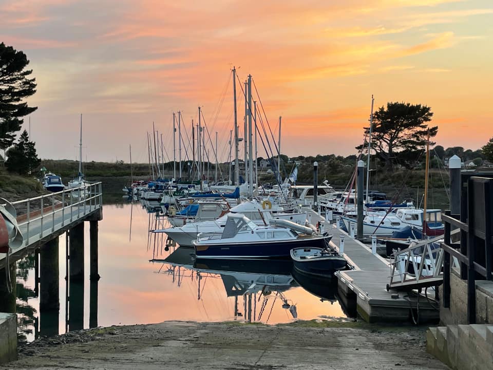
No. 11 Thornham Marina, Thornham Lane, Southbourne, West Sussex PO10 8DD
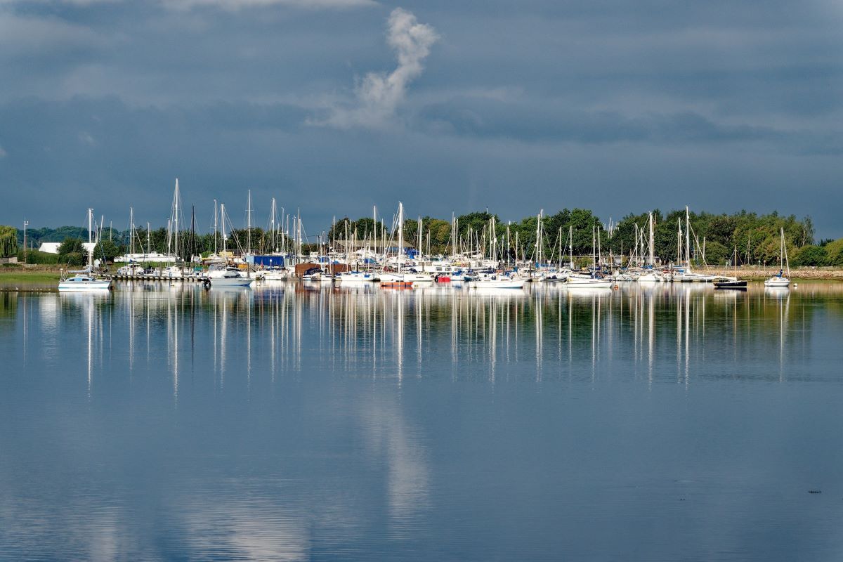
Thornham Marina link to website. Thornham Marina, Chichester Harbour - Traditional Values Modern Facilities


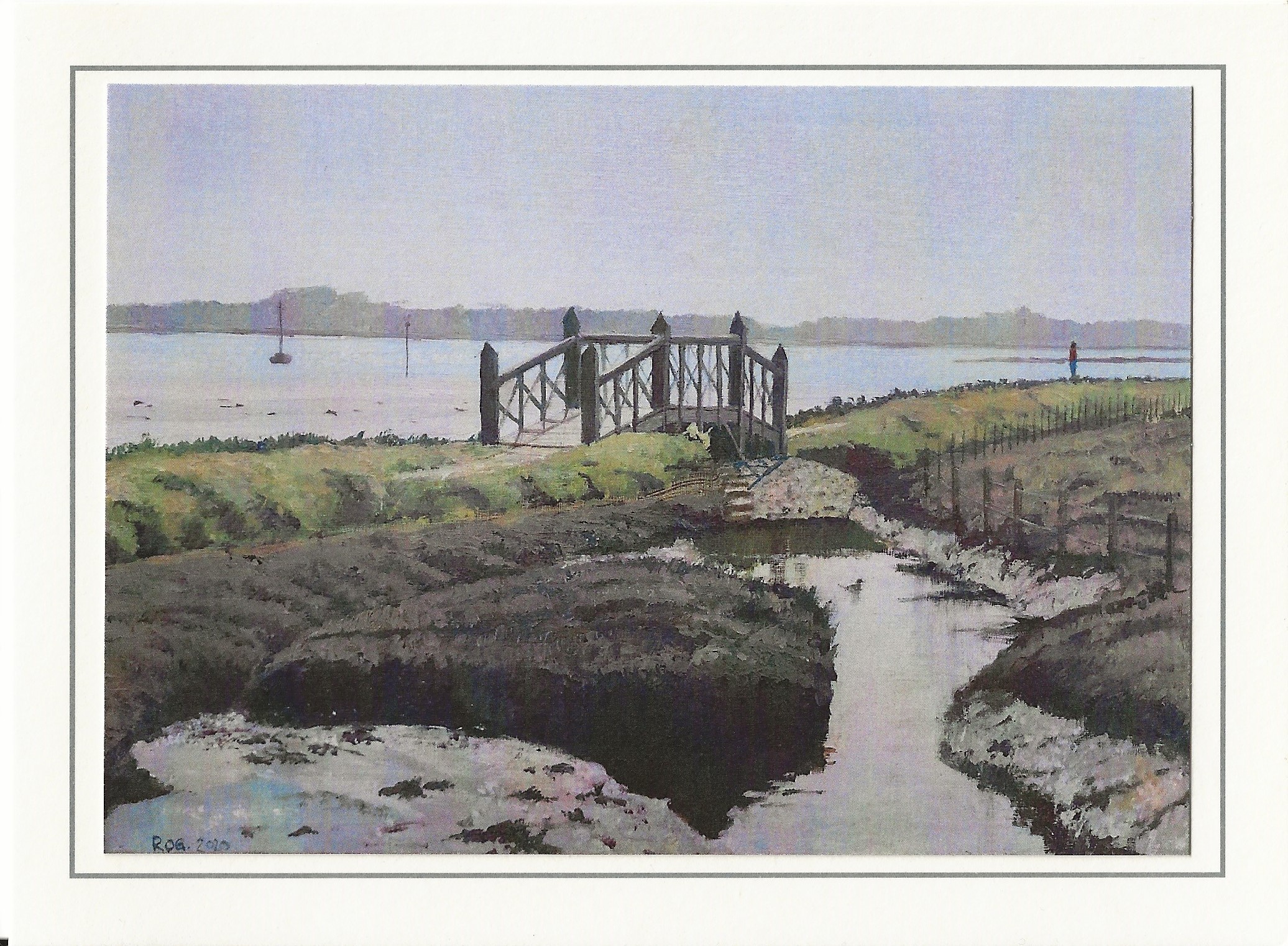
The bridge by the cuts/nature reserve was built by Andrew Oliver shipwright, he has a unit in Emsworth Yacht Harbour. The previous bridge (pictured below) was not safe so a new one was required. He used a special wood which is longer lasting than oak. This replacement bridge was built in 2018. https://www.andrewolivershipwrights.co.uk/
No. 14 Thornham Point Nature Reserve managed by Chichester Harbour Conservancy. awaiting picture
No. 15 Prinsted Point and bench seat. awaiting picture
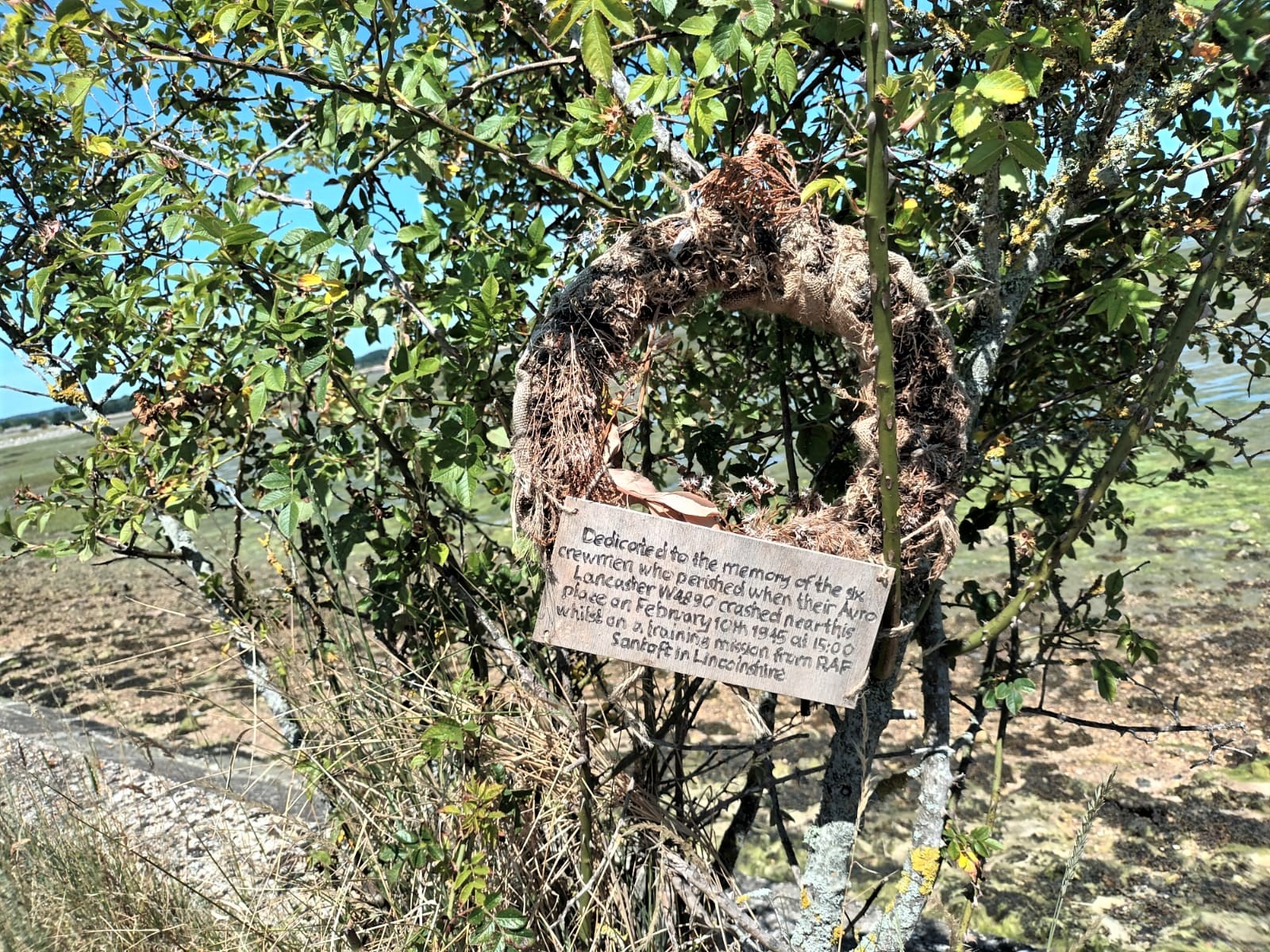
The crew of Lancaster I W4890 was:
Sgt. C.B. Darby, Air Gunner
Sgt. P.B. Kellegher, Air Gunner
Sgt. H. Metzer, Wireless Operator
Sgt. C. Woodhead, Navigator
P/O C.D. Callum
P/O H.S.J. King
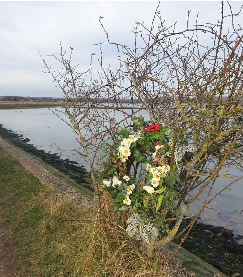
Wreath 2023 - Our thanks to Ian Darking for the plaque and wreath
Lancaster W4890 plunged out of the sky above Thorney Island on the afternoon of 10th February 1945, killing the entire crew who were from No.1667 Conversion Unit, RAF Santoft. The crew of this Lancaster were undergoing conversion from medium to heavy bombers, and had been briefed to fly a course between Santoft, Loftus, Royston, Gillingham, Hailsham, Ashford, Bagshot and back to base at a height of 20,000 feet. They took off at 12.25 and set course accordingly and at 13.56 a message was received at Santoft indicating that W4890 was in the vicinity of Royston. About an hour later, eye witnesses at Hayling Island and Thorney Island saw the aircraft through gaps in the clouds - it was at a great height and diving at considerable speed. During the dive pieces of the structure broke away, these included the outer mainplanes, wing tips, port outer engine, rear end of the fuselage and the tail unit. The main part of the Lancaster fell into a tidal creek 300 yards beyond the north-east perimeter track of RAF Thorney Island, it disintegrated and partially submerged on impact and was then ravaged by fire.
Portions of the airframe fell at varying distances from the main wreckage, many of them in the water. Part of an outer engine nacelle fell in Bosham, and a mile west of the village major portions of the tail unit and port wing tip were found on land. One engine was found 400 yards from the main wreckage but the three other engines weren't found. The pilot and wireless operator fell from the Lancaster as it broke up in the air and their bodies were found a few hundred yards away from the main site. The other four members of the crew were listed as missing.
The probable cause of the crash was given as loss of control when flying in cloud, resulting in a high speed dive leading to failure of the airframe and wings due to negative G and torsion. The investigators noted that; "This is another example of the many previous accidents associated with the known diving conditions of Lancasters at high speed following loss of control."

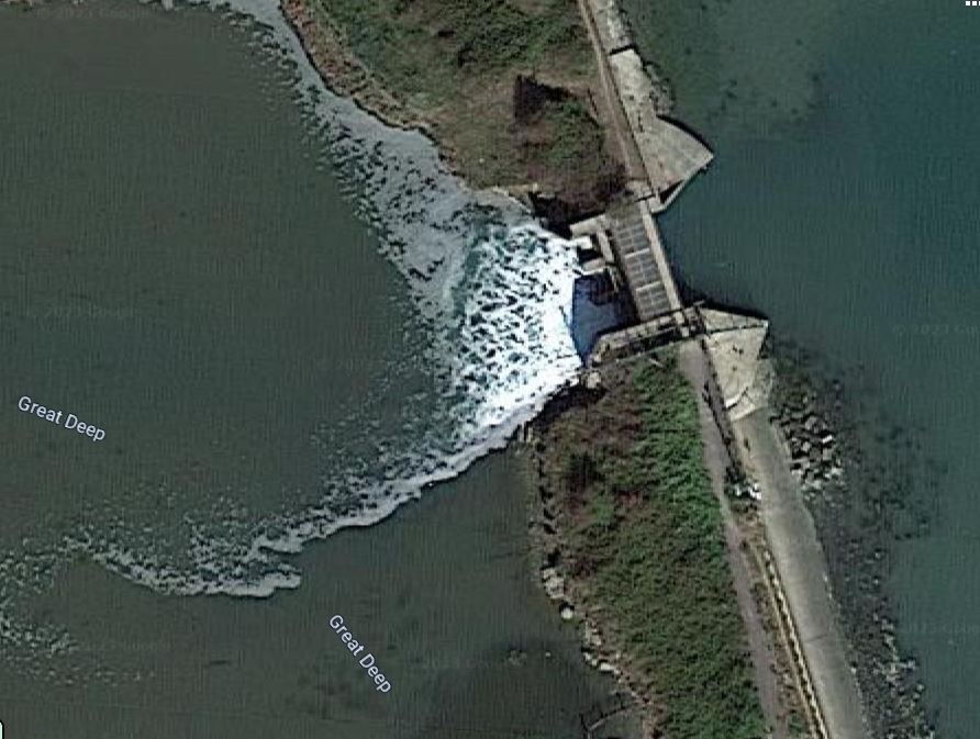
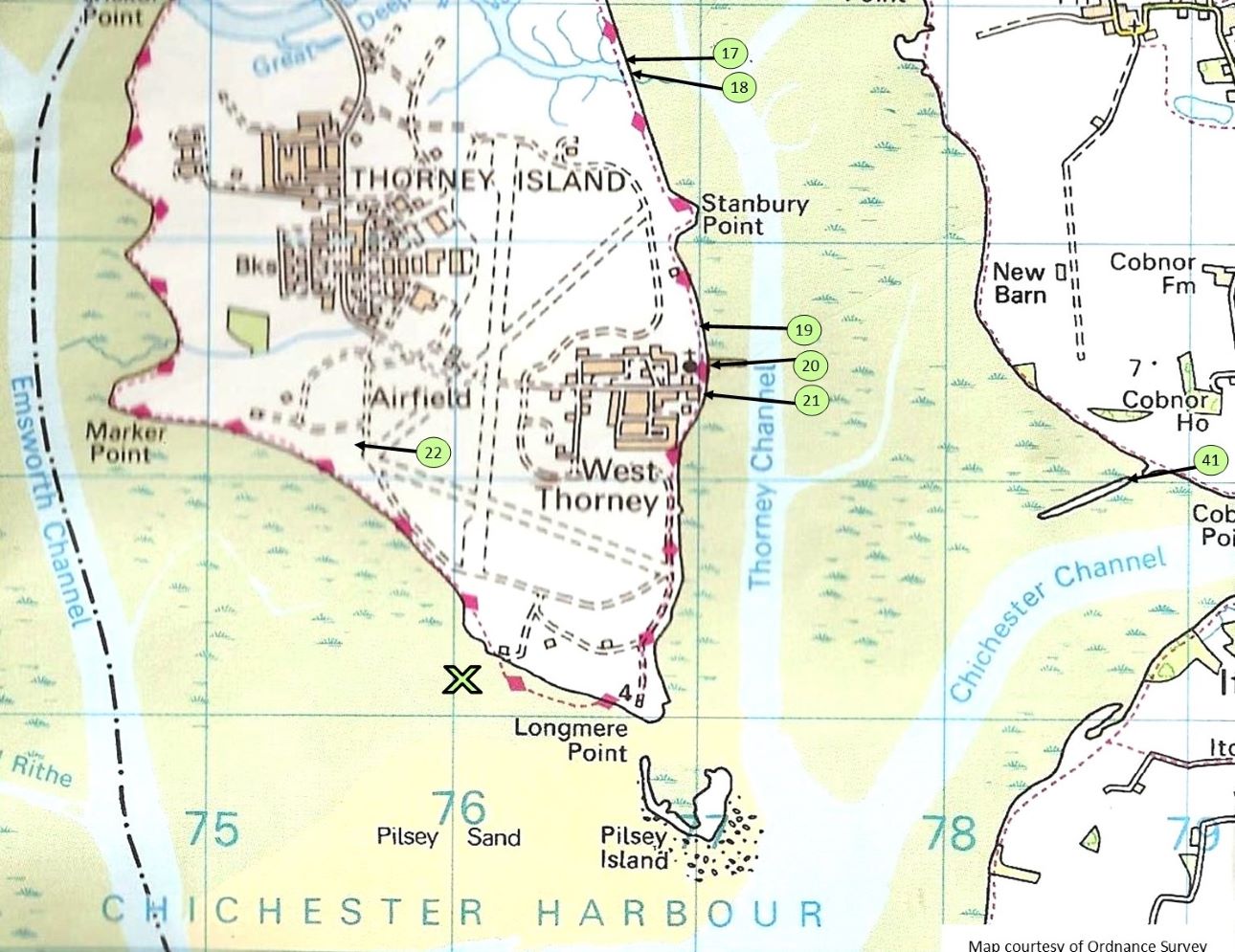
No. 18 Sewerage outlet at Great Deeps

No. 19 Memorial to the plane crash that led to the RAF buying Thorney Island for £50k.
Airfield built in 1938. Concrete runways laid in 1942
RAF closed in 1976.
Royal Artillery re-opened site in 1982
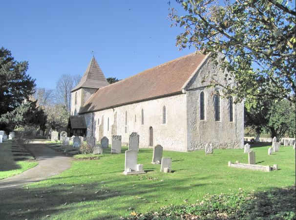
No. 20 St Nicholas - Thorney, Saxon Church

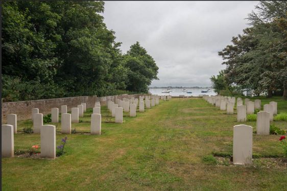
below aerial view of St. Nicholas Church and graveyard.
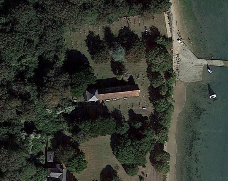
No. 20 St. Nicholas Church and military cemetery. RAF and German graves. Starting at North East corner, go anti-clockwise in date order, up across and back.
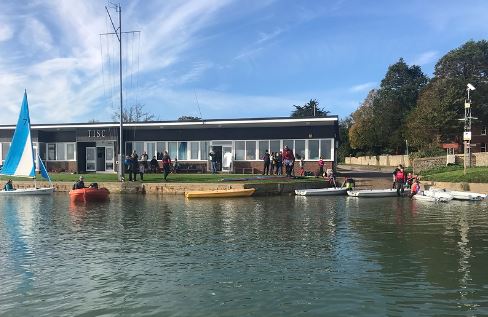
No. 21 Thorney Island Sailing Club

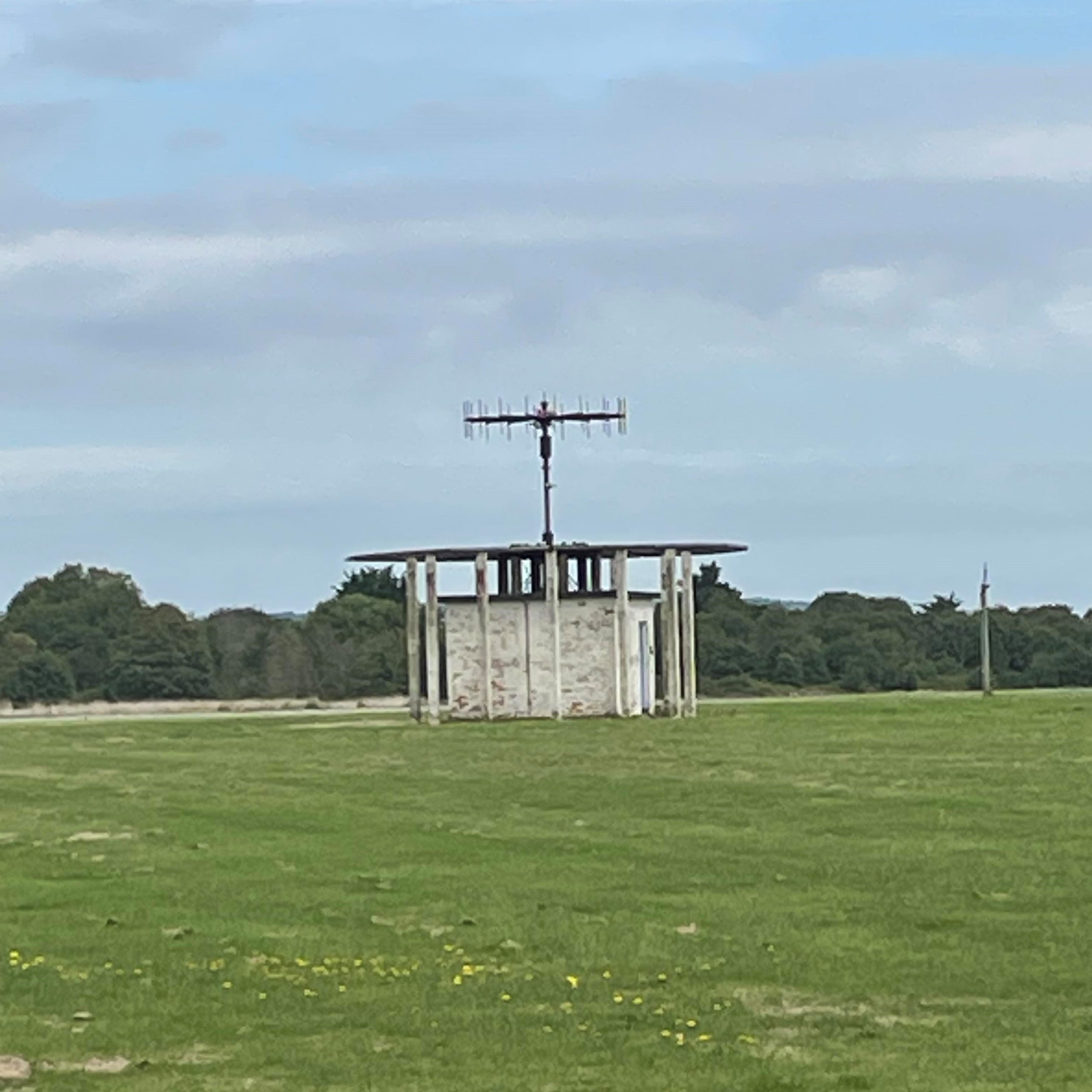
No. 22 Automatic Weather Station linked to Bracknell Met Office
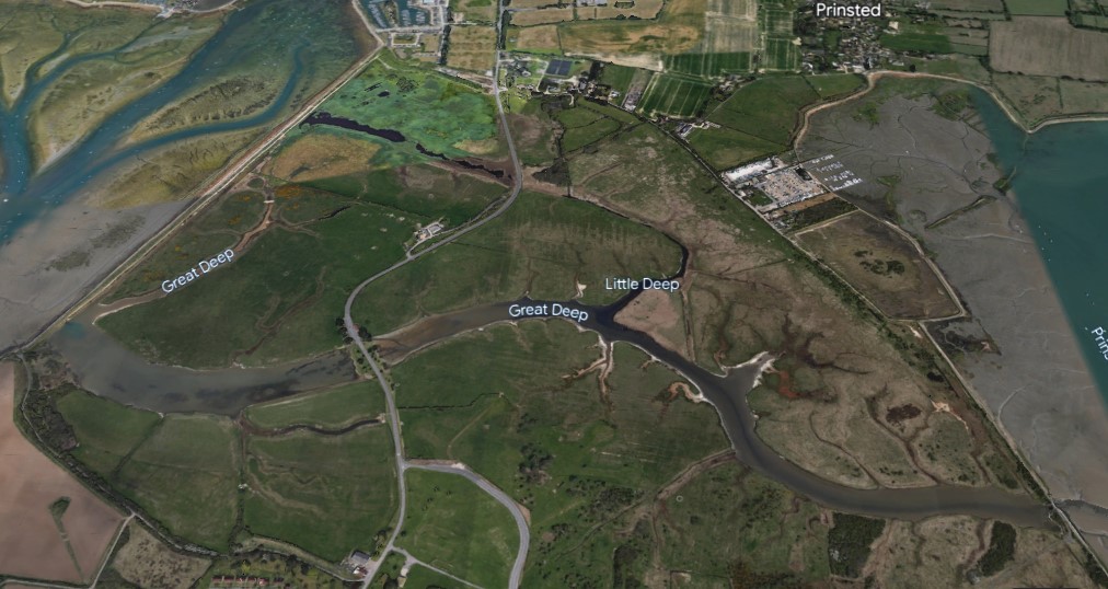
No. 23 The Deep marks the boundary between the MOD and Southbourne Parish Council administered land.


Named after Field Marshal Sir Geoffrey Baker, a former Royal Artillery officer, they have been home to 47th Regiment Royal Artillery since 1989.
In January 2008, 12th Regiment Royal Artillery moved to the island upon their return from Germany
No. 25 Eames Farm before and after renovation
The link below to the ChiHarbour Trust website which shows the land owned by them.

Our Land | ChiHarbourTrust (chichesterharbourtrust.co.uk)
No. 26 Thornham Sewage Works.
Water Quality - Chichester Harbour Conservancy

No. 27 Emsworth Yacht Harbour, Thorney Road, Southbourne, West Sussex PO10 8BP
Emsworth Yacht Harbour (emsworth-marina.co.uk)

No. 28 Tin Tabernacle, Thorney Road


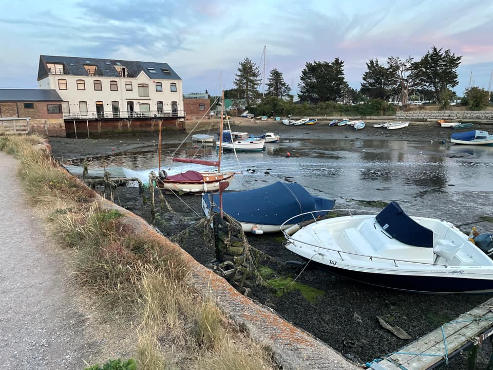
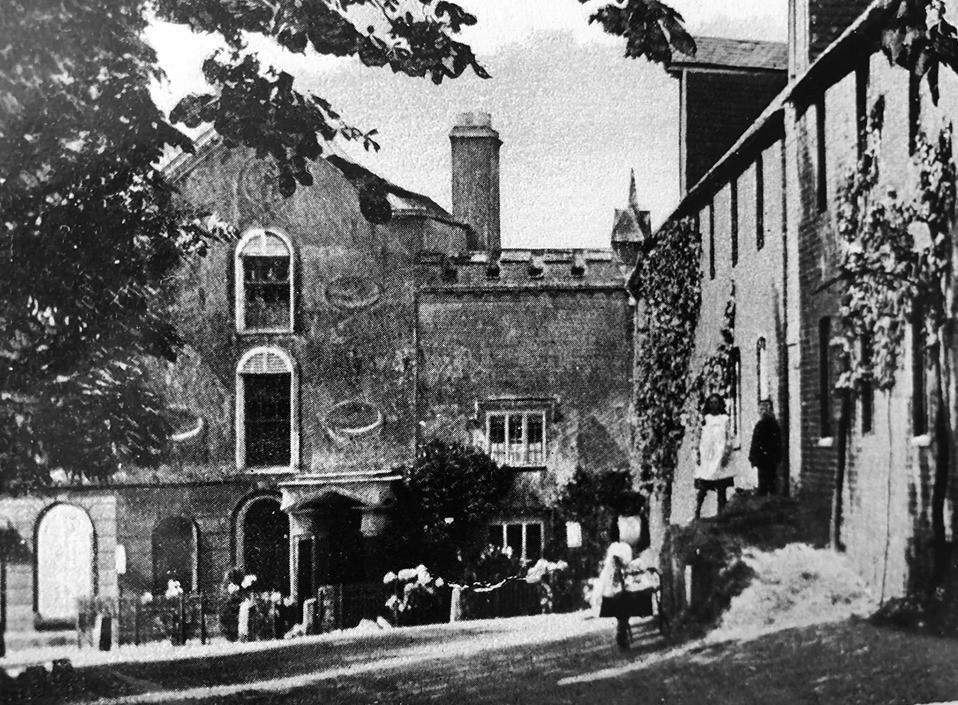
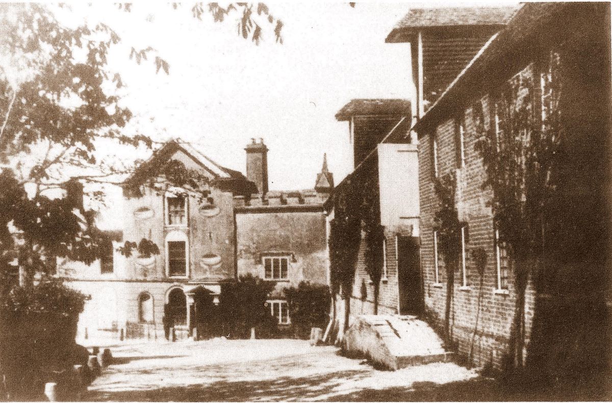
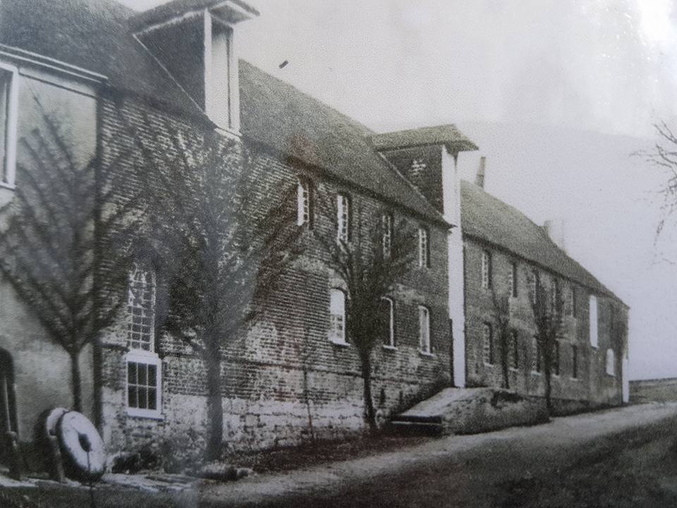
No. 29 Slipper Mill

Slipper Mill 1909
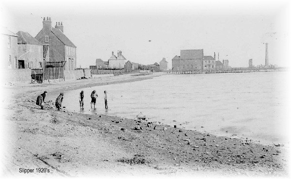
View of Slipper Road down to the Mill 1920s
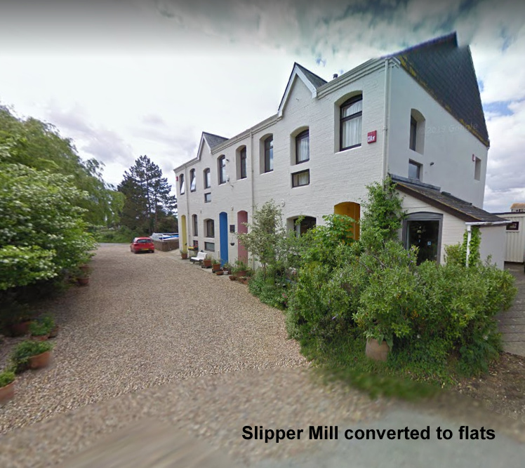
Slipper Mill 2022, now converted into flats
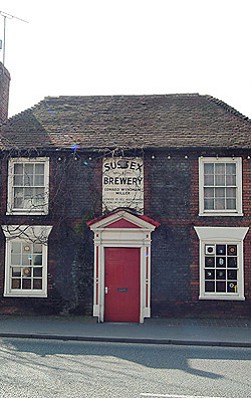
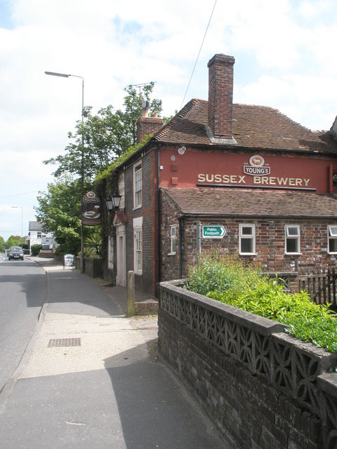
No. 30 Sussex Brewery - PO10 8AU link to website Sussex Brewery - Home. Pub and Drinks in Emsworth, Pubs with Fires, Pubs with Beers Gardens, Young's Ales, London, PO10
House built by the Miller family in 1749.
No. 31 Peter Pond is fed by the River Ems.
The pond is privately owned and managed.


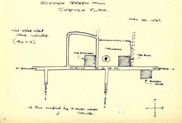
No. 32 Gosden Green and location of Windmill

Centre of the picture was the location of the windmill. See drawing below.


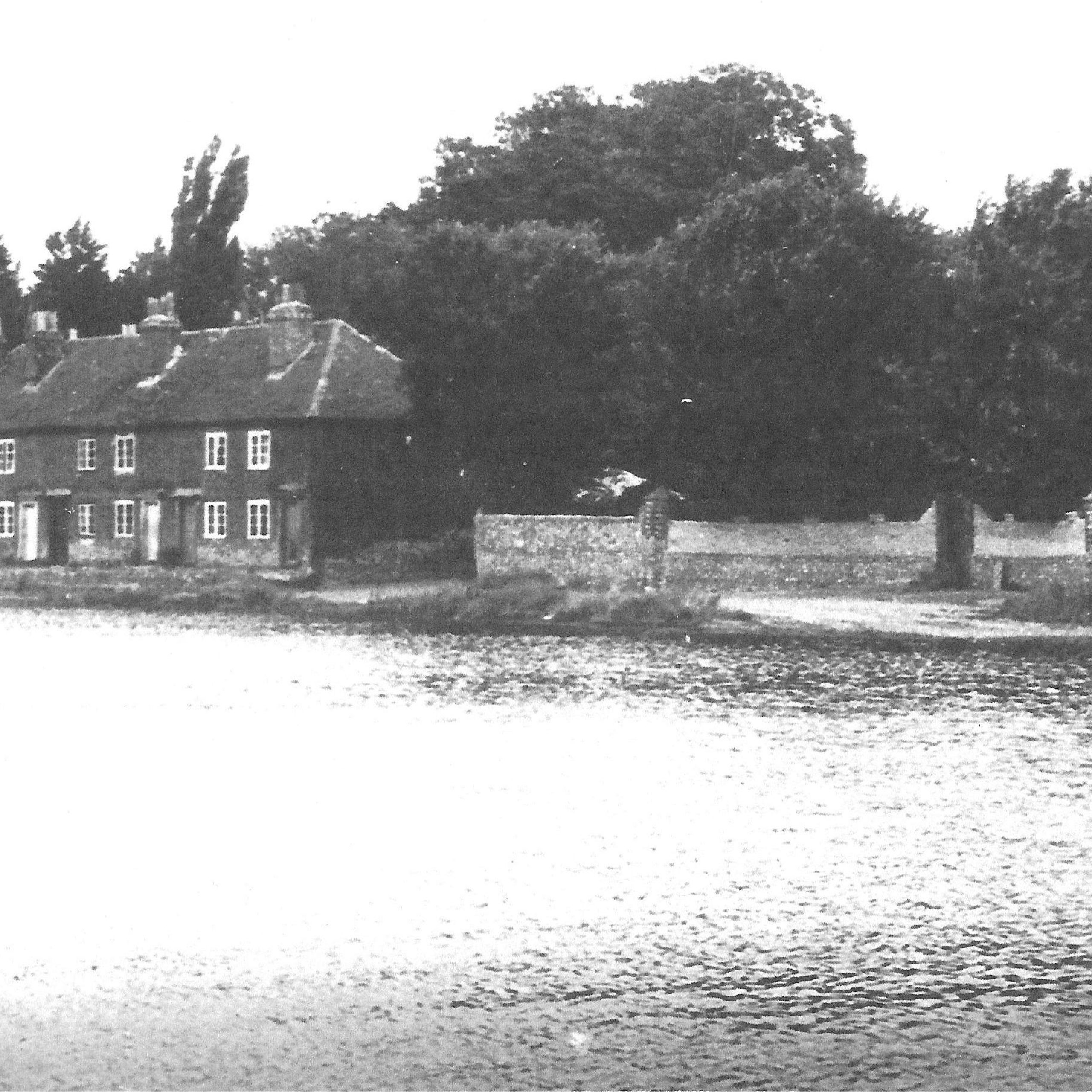
No. 33 Lumley Mill

Lumley Mill, was fed by the River Ems which rises about 0.5mile east of Stoughton, West Sussex. It passes through Westbourne and joins Chichester Harbour at Slipper. It's only about 6 miles long.
The Flour Mill was destroyed by fire on 15th March 1915
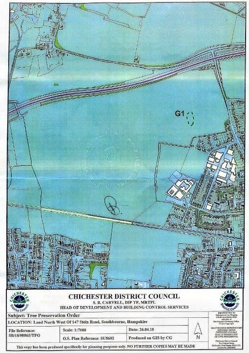
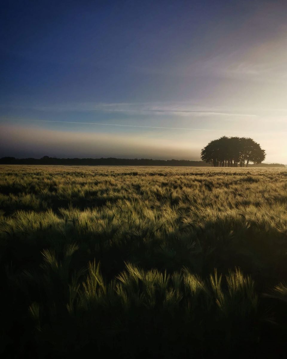
No. 34 Memorial Trees The A27 completed in 1989 is the Parish Boundary with Westbourne.
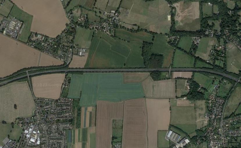

The memorial trees are just south of the A27.
We know they were planted between the wars, but we have no reason, nor can we find out who planted them. It is thought to be connected with uncompleted American Army Aerodrome, but as this was never used there is no evidence of this. The Land is owned by the Church Commissioners and would have been in Westbourne Parish at the time of planting. Concern was raised during the compilation of the first Southbourne Parish Neighbourhood Plan 2013-2015 when it was found not to be protected and a Tree Preservation Order came into force on 9th May 2018.
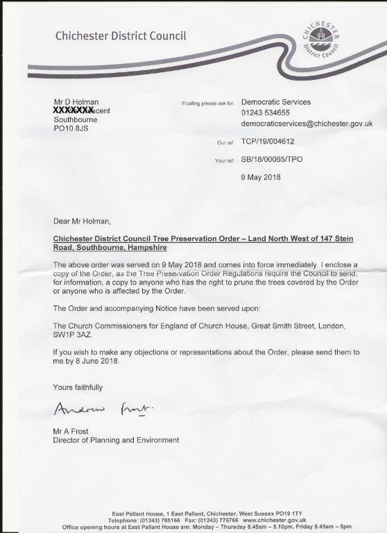
Tree Preservation order, confirmation letter to David Holman who had been in contact with the tree officer at CDC and told him what he knew about the trees.
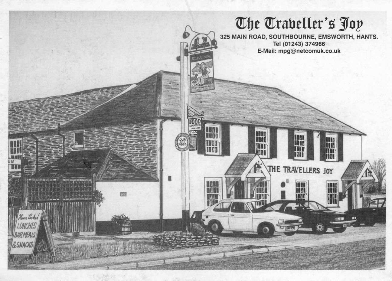
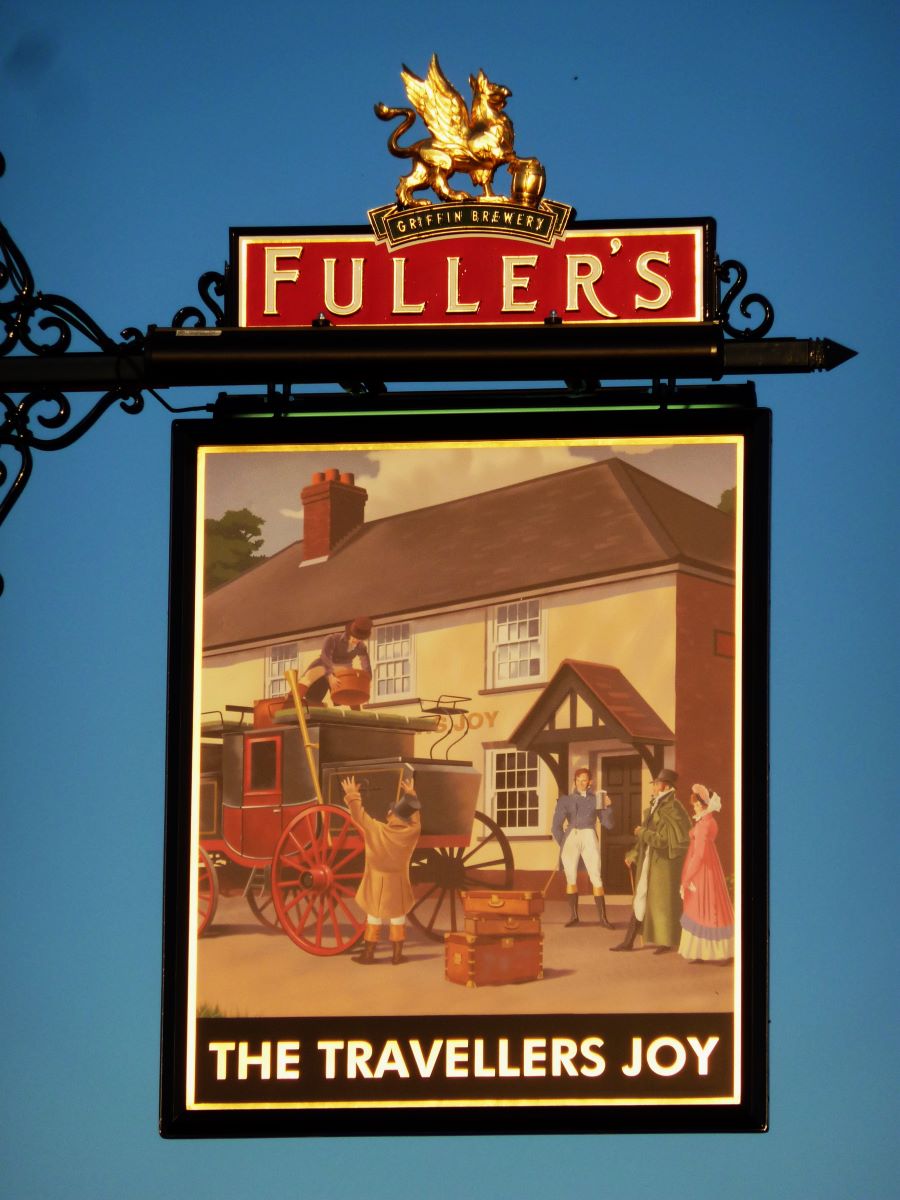
No. 35 Travellers Joy
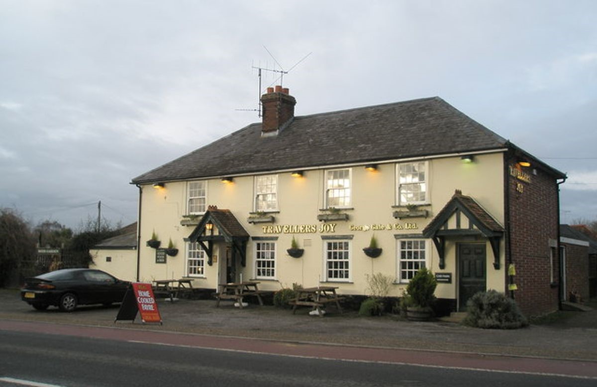
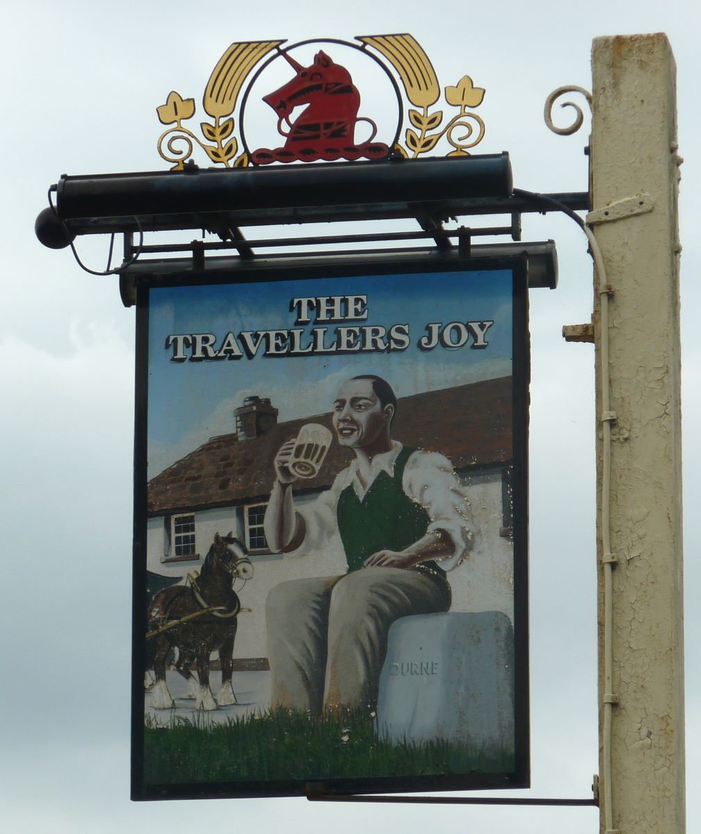
Below the Travellers Joy after the refurb about 2018 when the pub sign was changed

No. 36 Settlement Boundary Flint Wall. Manor of Prinsted/Manor of Nutbourne
No picture of this yet, but it's opposite the Travellers Joy.
No. 37 Ham Brook and ford. Farm Lane, Nutbourne.
No 38. Bunny Field
No. 39 Site of Nutbourne Tidal Mill
Details of the mill and the family that ran it can be found in the commerce section of this website.


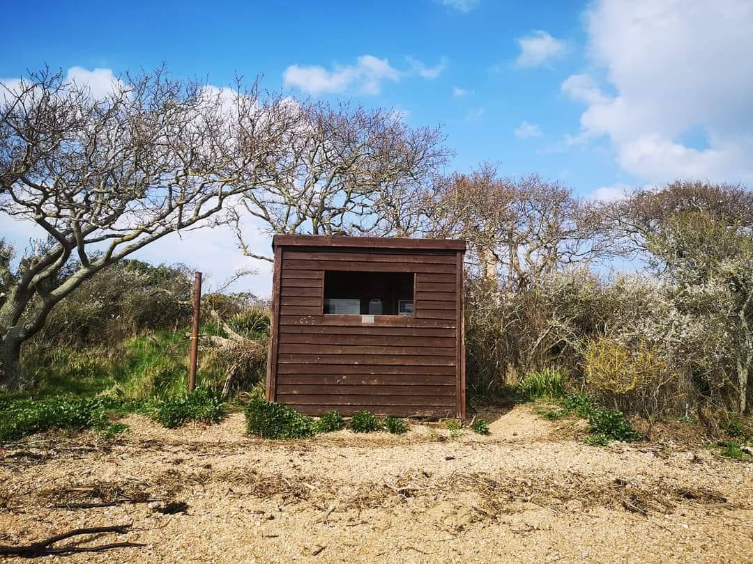
No. 40 Nutbourne Spit or Hinge
No. 41 Remains of the Shingle bank which ran from Cobnor to Thorney and broke through in the late 1800's.
Land reclamation information on St. NicholasTimeline website below
https://www.stnicholastimeline.org.uk/land-reclamation
Also shown is the bird watchers hut.

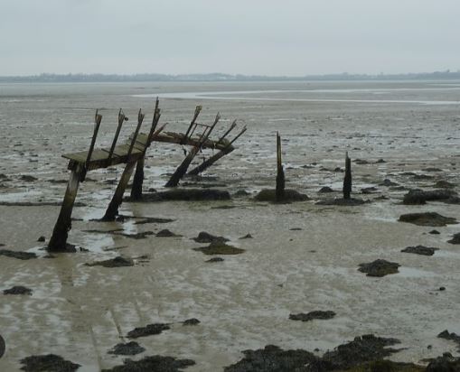
No. 41X Landing Light remains
A copy of the map is on the Sea Scouts Notice Board facing Prinsted Lane.